|
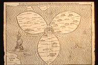
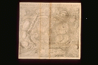
Northside Associated Ministries Ann Arbor, Michigan Northside Presbyterian Church/St. Aidan's Episcopal Church Adult Christian EducationAncient Land—Modern ConflictThe Historical and Political Geography of Israel and PalestineSupplement--Historical Maps of Israel and PalestineA large number of historical and modern maps of Israel and Palestine are available on the web. This page provides links to many of them, arranged more or less by historical period. I will be adding more maps as I come across them in the next few weeks, so check back. Because historical events and geographies are part of the contested facts in the modern conflict, users should note the source of the maps when you evaluate their "truthfulness." Contents:
Jerusalem Municipal Boundaries 1947-2000 (from Palestinian Academic Society for the Study of International Affairs) From the Foundation for Middle East Peace:
Jerusalem Settlements and Populations
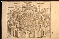
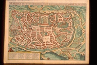
From Jerusalem 3000: Celebrating Three Millennia of History "Catalog of an exhibition at Osher Map Library and Smith Center for Cartographic Education, 15 May to 5 October 1996 |
